
In 2013, the project aimed at (1) sampling different parts of the site to determine their character and history of occupation, in order to guide future excavation strategy, (2) testing the hypothesis that Kurd Qaburstan was a major city of the Middle Bronze period, and (3) conducting a geophysical survey to study the urban layout of the city. Seven excavation units of 6 x 10 meters were opened.
High Mound Excavations
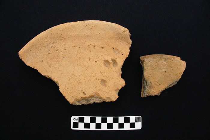
On the high mound, three trenches were excavated. In unit 5144/3044, on the high mound east, three human skeletons of subadult and adult age were found directly below the mound surface, without any associated artifacts. Below this were three phases of well-preserved mudbrick and baked brick architecture of the Late Bronze Age (Mittani period, ca. 1600-1300 BC). Excavations in unit 5088/3116 on the high mound north also revealed Mittani period mudbrick architecture and abundant pottery. Unit 4956/3030 on the high mound west had an upper level of Islamic material, four graves of an uncertain period (they contained no associated artifacts), and lower levels with Mittani period pottery but no observable architecture.
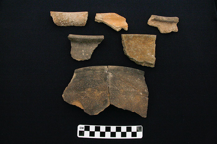
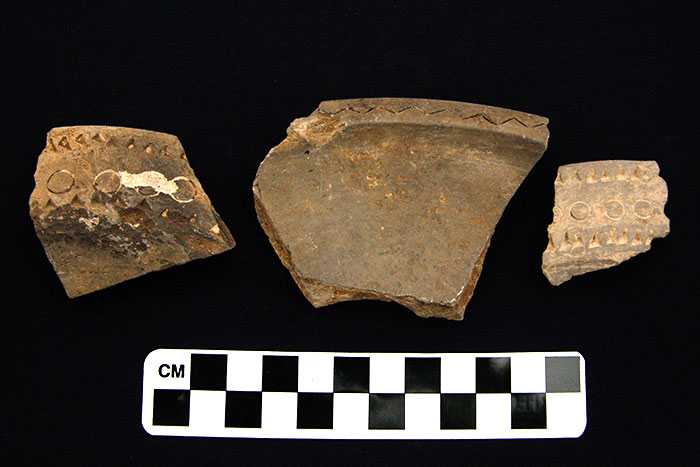
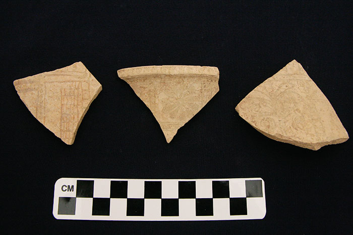
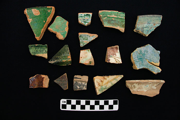
Thus far, we can observe that the Mittani pottery assemblage from Kurd Qaburstan includes such characteristics as (1) shallow bowls with beveled or simple rims, bowls with ledge rims, and bowls with square, block rims; (2) fine, thin-walled goblets with painted horizontal stripes and pedestal or button bases; (3) jars and kraters with square, block rims; (4) “piecrust” pot stands, (5) black burnished bowls with incised, impressed, and infilled decoration (“White Paste Inlay Ware”), and (5) rarely attested fine painted sherds with Nuzi Ware decoration or variations of Nuzi Ware. Red-edged bowls, a common diagnostic of Mittani contexts elsewhere, are so far absent from the Kurd Qaburstan assemblage.
While we know of the Mittani period in the Kirkuk region from the 1920’s-1930’s excavations at ancient Nuzi (Yorgan Tepa) (Starr 1937, 1939; Maidman 2010) and from the more recent excavations at Tell el-Fakhar (al-Khalesi 1977), much more needs to be learned about this period and culture, especially in the Erbil area (MacGinnis 2013).
Lower Mound Excavations
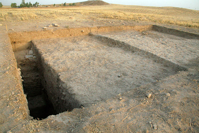

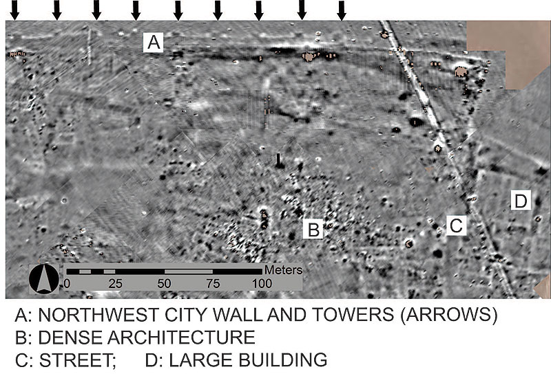
White masses observable on Corona satellite photographs of Kurd Qaburstan have been hypothesized to represent large-scale mudbrick architecture in the center of the lower town. To test this hypothesis, excavations were conducted in unit 5260/2846 in the central lower town. Excavations to a depth of 3 meters confirmed that significant architecture existed here, including an impressive baked brick wall preserved to 11 courses. The date of the strata excavated was middle Islamic (14/13th century AD).
A discrete white mass on the western lower town, hypothesized to be a large mudbrick building, was explored through excavations in unit 4844/2806. No architecture was identified, only occasional cobble surfaces or stone hearths, contradicting the proposed hypothesis. As in the central lower town, the date of the sampled occupations was Islamic.
City Wall Excavations
Two trenches were opened at the location of the presumed city wall in order to determine its existence, character, and date. In unit 4666/3076 on the west, excavations revealed a homogeneous soil matrix without evidence of architecture; in the western, outer part of the excavated area, no artifacts were retrieved, while Middle Bronze pottery and other remains appeared in the eastern, inner part of the trench. Similar results were obtained in unit 4946/3454 in the north. We hypothesize that the outer parts of the two trenches, without evidence of artifactual material, comprise parts of the city wall, constructed either of mud or mudbricks that have merged into a single soil mass, while the inner parts consist of strata deposited against the wall. The geophysical survey results support this interpretation for unit 4946/3454.
Geophysical Survey
Geophysical survey directed by Andrew Creekmore (University of Northern Colorado) included the use of magnetometry and conductivity to determine evidence of the ancient urban layout immediately beneath the mound surface. Covering ca. 12 hectares, the magnetometry survey revealed a densely occupied urban landscape enclosed by a city wall with towers at regular intervals. Given the results of surface survey, the date of this occupation is most likely Middle Bronze (Old Babylonian).
Conclusions
It is evident from the 2013 results that Kurd Qaburstan is, as was posited, the site of a very large Middle Bronze period walled city. In addition, significant Mittani period remains are now attested and accessible just below the surface on the high mound.
References Cited
al-Khalesi, Y.
1977 Tell el-Fakhar (Kurruhanni), a Dimtu Settlement. Assur 1. Malibu: Undena
MacGinnis, J.
2013 Erbil in the Cuneiform Sources: A Catalogue and Historical Assessment. Erbil: Kurdistan Regional Government Ministry of Culture and Youth.
Maidman, M.
2010 Nuzi Texts and their Uses as Historical Evidence.
Writings from the Ancient World, vol. 18.
Atlanta: Society for Biblical Literature.
Starr, R.
1937 Nuzi. Report on the Excavations at Yorgan Tepa Near Kirkuk 1927-1936. Vol. 2. Plates and Plans.
Cambridge: Harvard University Press.
1939 Nuzi. Report on the Excavations at Yorgan Tepa Near Kirkuk 1927-1936. Vol. 1. Text.
Cambridge: Harvard University Press.